1/27/25 Forecast
We return back to calm and clear conditions for most of the week. However, a pattern change looks likely as we start February.

Taken January 27th from the top floor of the Dean. A bird flies away with the freshly snow-coated Sierras in the background.
Monday

500mb map depicting a cutoff low spinning over Southern California.
With our low pressure system leaving the area, cold and dry air will be left in its wake. A northeasterly flow will kick up winds over the Sierra ridges (up to 50mph) Monday night into Tuesday, but conditions will be light and variable in the Reno-Sparks area. Max temperatures stay below average with remionwide highs in the low 40s.

NWS NDFD’s forecast for Monday’s high temperatures
Resultant cold air will keep low temperatures in the low 20s to high teens for Monday night.
Tuesday
The cutoff low slowly meanders eastward Tuesday leaving us with very similar conditions here in Reno-Sparks as Monday.

500mb map showing the cutoff low in nearly the same place as Monday.
High temperatures will be slightly higher than Monday’s bumping up to the mid 40s. Winds will be calm and clouds will be hard to find. A morning inversion is also likely to occur, as highlighted by the NWS in their forecast discussion.
Wednesday
Our warm-up continues Wednesday as the closed low drifts eastward.

NWS’s NDFD showing high 40s and low 50s for most of the region
High temperatures will rise to near-averages Wednesday. A strong inversion is also likely to persist throughout the day, trapping in smog during the daylight hours.
Thursday and Beyond
From Thursday until the weekend, it is likely that we will be under a ridging pattern. This will lead to above-average temperatures and calm conditions. High temperatures will steadily rise into the the high 50s by Saturday and Sunday.

The Euro Ensemble mean 500mb height for Friday. We looked locked in for a ridge for the later portion of the week.
However, there are signs that we may get some atmospheric river (AR) activity the first couple days of February.

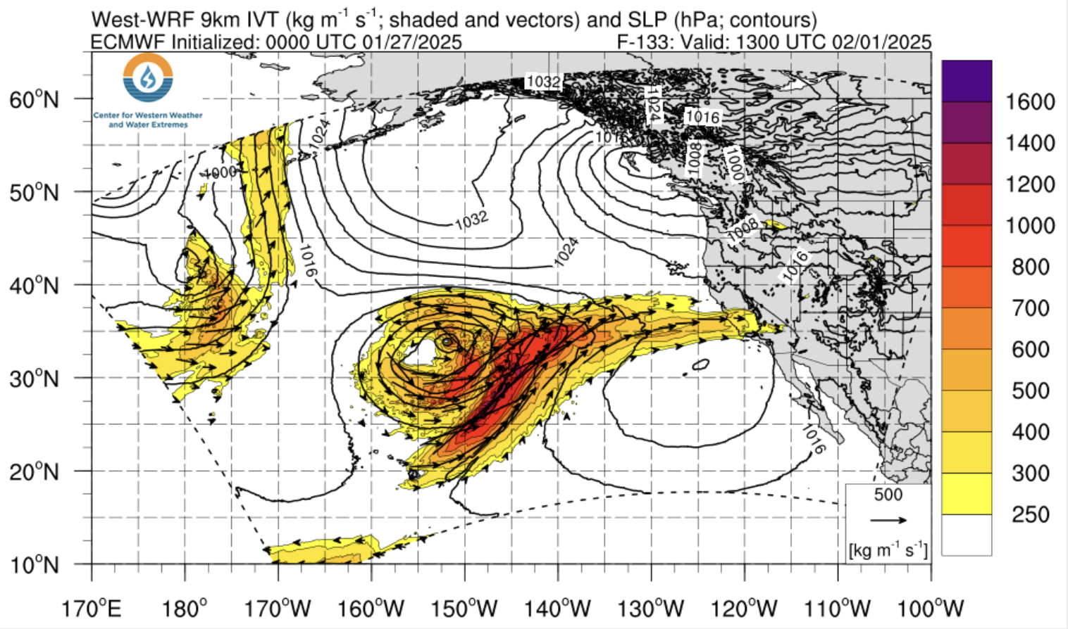
Both the Euro and GFS show a plume of moisture extended into NorCal by February 1st, with precipitation chances for our region starting a couple days after that. Overall, these storms don’t look like significant precipitation producers, but we are still over a week away from this happening.

Euro Ensemble 15-day precipitation matrix for Reno.
A rough timeframe for these next storms seems to be one between February 1st-3rd and another potentially between February 5th-7th.
Key Messages
As our cutoff low exits, temperatures stay low, but rise as the week goes on.
Morning inversions will be present from Tuesday into the weekend
Early February may provide some chances are boosting our severely underperforming snowpack, one Feb. 1-3 and another Feb 5-7.