1/24/25 Forecast
It may seem nice now, but winds and snow await us very soon here in Reno-Sparks.

Taken January 24th. An array of clouds over the Reno skyline seen from the Dean.
Friday-Saturday
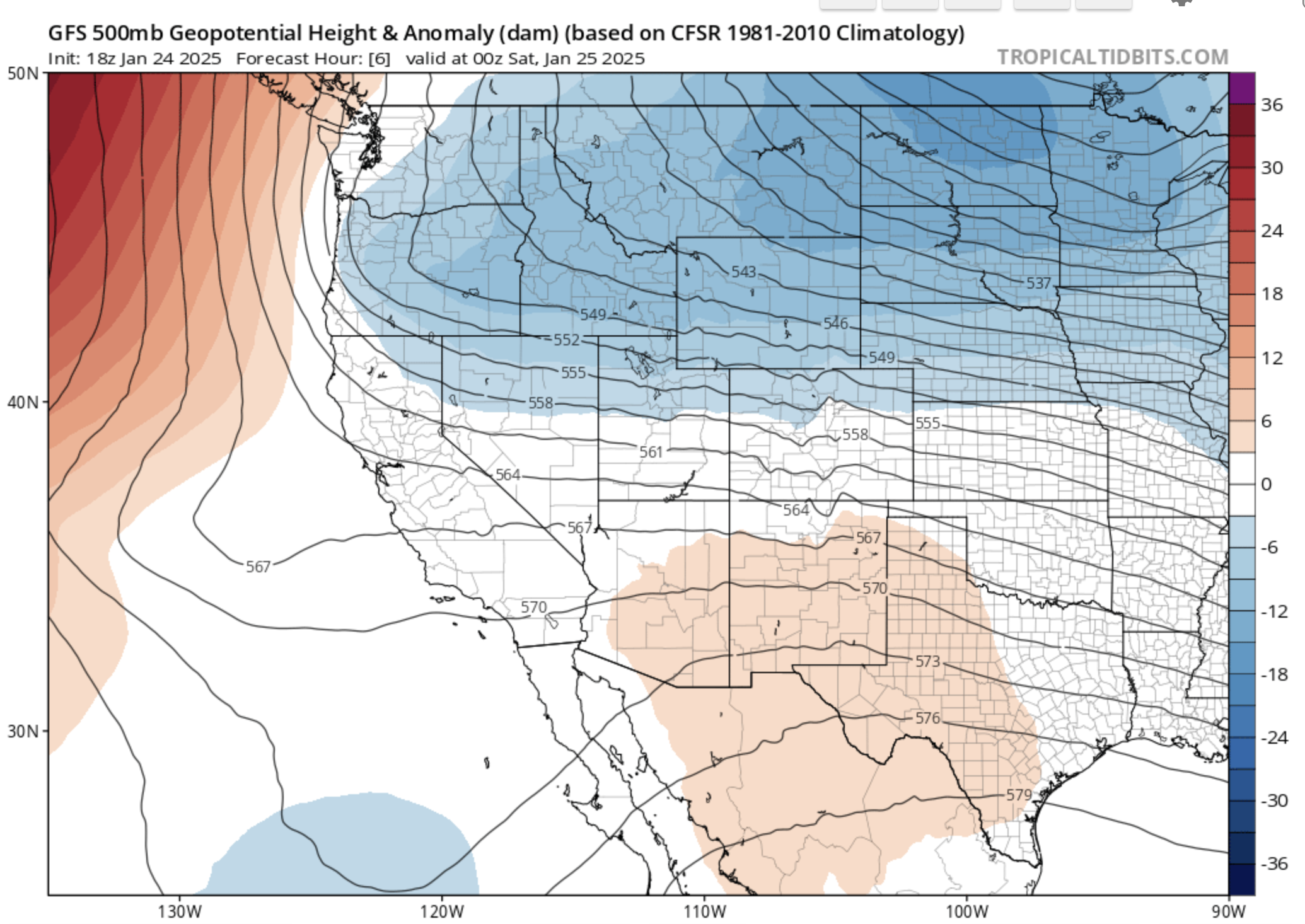
500mb map depicting a shortwave pushing southward towards the Western U.S.
Our low pressure system is well on its way down south toward our area. Winds will pick up later tonight into tomorrow morning, which is a little later than previously thought. Wind speeds will max out around 30mph in the valley.

The Friday 21z HRRR’s depiction of the winds by midnight tonight.
Temperatures behind the cold front of this system will send lows down to the low 20s tonight. We are also finally in the range of the short-term high resolution models. Let’s take a look at what the HRRR shows for snowfall coverage.
The HRRR is quite bullish on snowfall for our area, showing precipitation starting around 7pm for the valley and continuing until Sunday morning. Snowfall amounts of 1-4 inches for the valley are implied with this run.

The National Blend of Models (NBM) showing 2-4 inches for the Reno-Sparks region.
The NBM is also quite bullish on snowfall potential for Reno, with it explicitly showing 3 inches for the valley floor. I would take this model to be on the ceiling end of potential outcomes.

The current batch of advisories and warnings for our region.

The NWS’s predicted snowfall from the current winter weather advisory
Snowfall amounts seems to generally range from 1-4 inches combining the NWS’s forecast and high resolution models. This is a bit of a bump up from yesterday as the “floor” for snowfall seemed to be a bit lower than it is now.
Sunday and Beyond
After the low exits, temperatures will stay well-below average in the high 30s and low 40s before warming up into the mid-week. Overnight and morning lows will still be frigid, sticking in the teens and low 20s.

7-day temperature forecast for Reno
Even beyond this week, signs are starting to show for more of a distinct pattern change. The first couple days of February are lighting up with weak to moderate storms for our area in the Euro ensemble. However, this is just outside of the 7 day forecast period, so this isn’t by any means a home run.

Highlighted in red is the signal the Euro ensemble is showing for precipiation chances in early February
Key Messages
A low pressure dropping in Friday night will bring gusty winds, below average temperatures, and a good shot at light snowfall for the valley during the day Saturday into Sunday morning
As we get to the mid-week begins, temperatures stay low, but rise as the week goes on
Early February may provide some chances are boosting our severely underperforming snowpack